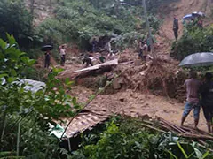
The two hill districts of Uttarakhand, Rudraprayag and Tehri, are at the highest risk of landslides. This has been revealed in the latest ‘Landslide Atlas’ report of ISRO’s Hyderabad-based National Remote Sensing Center (NRSC). These districts are at the top in the list of landslide danger.
The National Remote Sensing Center has released a list of 147 districts vulnerable to landslides across the country. In this, Rudraprayag is first and Tehri is second.
Chamoli is at number 19
Recently, Chamoli district, which came into the limelight due to landslide in Joshimath, is at number 19 among the districts prone to landslides. According to the information received from the Emergency Operation Center of Rudraprayag, there are 32 old landslide areas in the district. Most of these are located on National Highway 107. Similarly Tehri along with Totaghati has been identified as a very ancient landslide site.
The special thing is that all the 13 districts of Uttarakhand are included in this list. While Rudraprayag and Tehri are at the first and second place, Haridwar and Udham Singh Nagar are at the bottom of the list at 146th and 147th place respectively.
The famous Kedarnath Dham is located in Rudraprayag which is on the top of the list. In 2013, there was a terrible disaster here in which thousands of people were killed. Sirobgarh and Narkota areas of Rudraprayag are most affected by landslides. Landslides are reported here throughout the year. At the same time, with the arrival of monsoon, cases of landslides increase in most of the areas.
Vulnerable to earthquakes
Uttarakhand is a very sensitive state in terms of landslides. Data from the State Emergency Operation Center shows that between 2018 and 2021, 253 landslides occurred in Uttarakhand. 127 people died in this. The Atlas report states that over 11,000 landslides have been recorded in Uttarakhand in the last two decades. Among these, maximum landslide areas fall on Rishikesh-Rudraprayag-Chamoli-Badrinath, Rudraprayag-Ukhimath-Kedarnath, Chamoli-Ukhimath, Rishikesh-Uttarakashi-Gangotri route.
According to the Landslide Atlas, other districts highly vulnerable to earthquakes include Rajouri and Pulwama in Jammu and Kashmir, Thrissur, Palakkad, Malappuram in Kerala, South Sikkim and East Sikkim in Sikkim.
Must Read: Maharashtra: Chaos in Yavatmal! Underground pipeline burst blows up the road, watch how it happened
Keep watching our YouTube Channel ‘DNP INDIA’. Also, please subscribe and follow us on FACEBOOK, INSTAGRAM, and TWITTER.
